


Geographic Information System
Geographic Information System의 설명
이 앱은 자세한 메모, 다이어그램, 방정식, 공식 및 코스 자료와 함께 중요한 모든 주제를 다루는 Geo Informatics System의 완전한 무료 핸드북입니다.
이 앱에는 자세한 메모, 도표, 방정식, 공식 및 코스 자료가 포함된 100개의 주제가 있으며 주제는 5개의 챕터로 나열되어 있습니다. 이 앱은 모든 공학과 학생들에게 필수 앱입니다.
토목 및 기타 엔지니어링 프로그램 및 학위 과정을 위한 참고 자료 및 디지털 북으로 앱을 다운로드하십시오.
응용 프로그램은 시험 및 인터뷰 시간에 빠른 학습, 수정, 참조를 위해 설계되었습니다.
이 앱은 대부분의 관련 주제와 모든 기본 주제에 대한 자세한 설명을 다룹니다.
이 지리 정보 시스템 앱에서 다루는 주제 중 일부는 다음과 같습니다.
1. GIS 소개
2. GIS를 지리계산으로
3. 기술적 촉진
4. GIS의 기본 기능
5. GIS의 시스템 정의
6. GIS 과학과 지리정보공학의 부상
7. 따라야 할 GIS 과학
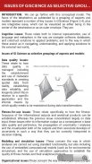
8. 측면의 선택적 그룹화로서의 지리학의 문제
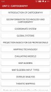
9. 지도제작의 소개
10. 지리정보 기술과 지도제작
11. 좌표계
12. 글로벌 시스템
13. GIS 전문가를 위한 프로젝션 기초
14. 지도 규모
15. 지도 투영
16. 기하학적 변형
17. 벡터 및 래스터 데이터
18. GIS의 SAPATIAL 현상
19. 공간 데이터 기능
20. 데이터 수집 기술
21. 원격 감지
22. 지상 조사
23. 환경모델의 역할과 성격
24. 환경 모델링의 맥락
25. 모델 개발 요약
26. 모델 적용
27. 산사태 모델링
28. 지형 모델링
29. 모델의 유형
30. 모델링에 대한 접근
31. 지리 역학의 표현 및 계산
32. 시간적 모델링
33. 시간 GIS
34. 데이터베이스 개념
35. 데이터베이스 설계
36. 데이터 입력 기법
37. 데이터 인코딩
38. 글로벌 포지셔닝 시스템(GPS)
39. 인코딩과 디코딩의 비교
40. 지도 레이아웃
41. 지도 레이아웃 요소
42. 맵과 시퀀스 완성하기
43. 시퀀싱 기술
44. 매핑 기술
45. 모델 평가
46. 지도 대수학
47. 대수 입력 유형 매핑
48. 오버레이 분석
49. 벡터와 래스터 오버레이
50. 타레인 모델링
51. 공간 보간
52. 전송 기능
53. GIS와 인공신경망
54. 네트워크
55. GIS와 네트워크 분석
56. GIS의 수자원 응용
57. 수문 모델링
58. GIS와 사회
59. GIS 및 운송
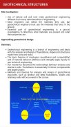
60. 지반 공학 특성의 GIS 기반 평가
61. 지반 공학 구조
62. GIS에서 SPATAIL 데이터 생성
63. 웹 매핑
64. 웹 기반 디자인의 중요성
65. 환경 영향 분석
66. 지도 서비스
67. EFA 모니터링 시스템의 구축 및 개발
68. 유틸리티 관리의 GIS
69. 주제 매핑
70. 재구조화-가속화된 권력 개발 및 개혁 계획
71. 유틸리티 관리의 GIS
72. 주제별 매핑
73. 구조조정 가속화된 권력 개발 및 개혁 계획
74. 사진 측량
75. 모바일 매핑
글자 수 제한으로 인해 모든 항목이 나열되지 않습니다.
특징 :
* 장 현명한 완전한 주제
* 풍부한 UI 레이아웃
* 편안한 읽기 모드
* 중요한 시험 주제
* 매우 간단한 사용자 인터페이스
* 대부분의 주제를 다룹니다.
* 한 번의 클릭으로 모든 도서 관련 정보 얻기
* 모바일에 최적화된 콘텐츠
* 모바일에 최적화된 이미지
각 주제는 더 나은 학습과 빠른 이해를 위해 다이어그램, 방정식 및 기타 형태의 그래픽 표현으로 완성됩니다.
이 앱은 빠른 참조에 유용합니다. 모든 개념의 수정은 이 앱을 사용하여 몇 시간 안에 완료할 수 있습니다.
우리에게 낮은 등급을 제공하는 대신, 귀하의 쿼리, 문제를 메일로 보내주시고 향후 업데이트를 위해 고려할 수 있도록 소중한 등급 및 제안을 보내주십시오. 기꺼이 해결해 드리겠습니다.
Geographic Information System - APK 정보
APK 버전: 11.0패키지: engg.hub.geoinformatics.systemGeographic Information System의 최신 버전
다른 버전들


동일 카테고리의 앱
 4.274.334.36
좋아할 만한 것...


